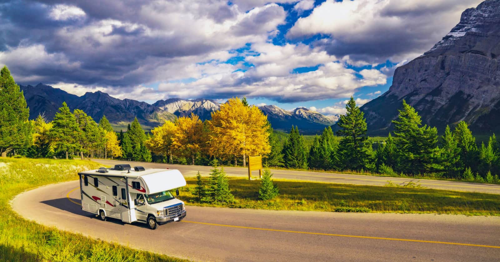
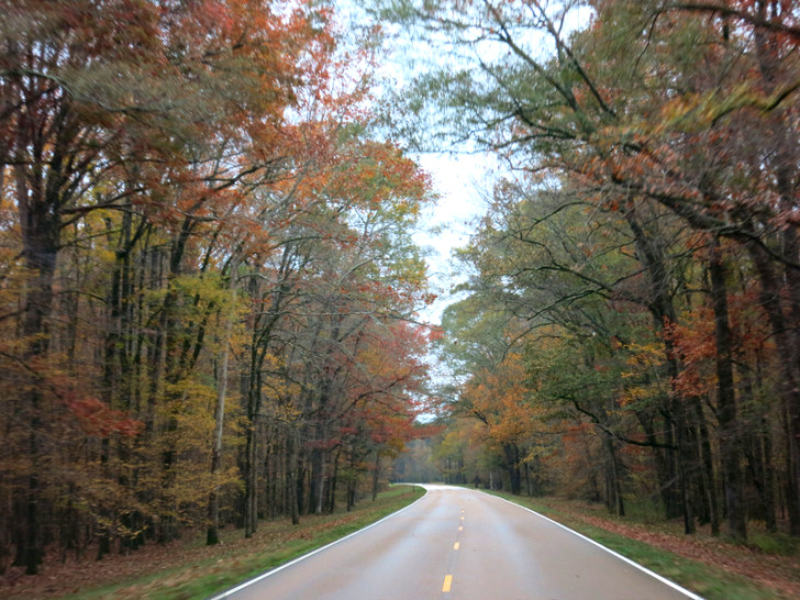
National Scenic Parkways like the Natchez Trace are a dream come true for RV travel. With an abundance of natural scenery and historic sites, light traffic, well-maintained roads, an RV friendly speed limit, and several free campgrounds, the only possible downside is that after driving the Trace all other roads will pale in comparison.
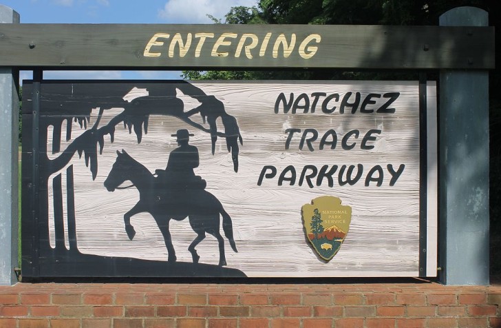
What Is the Natchez Trace Parkway?
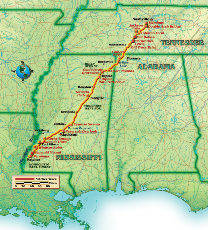
The Natchez Trace meanders along a gently curved greenway for 444 miles through three states. From the foothills of Nashville, Tennessee in the north, to the low lying salt marshes of Natchez, Mississippi in the south, this all-American road encourages travelers to experience the sites at a leisurely pace perfectly suited for RV travel.
A Drive Through Time
The modern day Natchez Trace commemorates an ancient trail that for centuries has provided a travel corridor through the old southwest. The Trace was first used as a foot path by the Natchez, Choctaw and Chickasaw American Indians to follow herds of bison and other game on their migratory routes.
Later it became a popular route for travelers during the westward expansion of the United States. In 1801 it was designated as a post road for mail delivery, and in the early 1800s through the mid-1820s the Trace became a return road for the “Kaintucks” of the Ohio River valley after floating goods and live stock down the Mississippi River.
Finally, in 1938 it was designated as a National Scenic Byway that is preserved and maintained by the National Park Service for those who wish to travel by car, RV, or bike.
Hiking and History on the Natchez Trace
There are over 100 historic stops and hiking trails along the Natchez Trace. They are all well marked with signs and – with the exception of one or two side roads that specify “No RVs” – are RV friendly with plenty of parking. You could easily spend weeks exploring all that the Trace has to offer. Here is just a small sample of the offerings.
Tennessee:
Gordon House Historic Site, milepost 407.7 – Visit the site of this early 1800s trading post and ferry.
Trail to Jackson Falls, milepost 404.7 – Hike the short, steep, paved trail to a clear pool at the base of the falls.
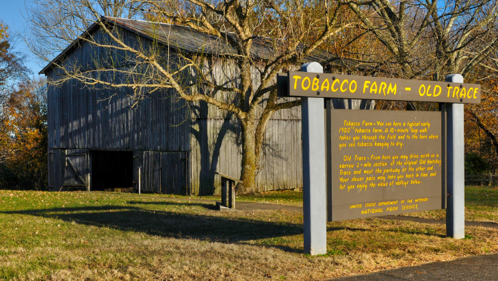
Old Tobacco Farm, milepost 401.4 – Learn about growing and drying of tobacco at this early 1900’s farm.
Fall Hollow Trail, milepost 391.9 – Take a short walk to a viewing platform overlooking the tumbling falls.
Meriwether Lewis Memorial, milepost 385.9 – Visit the gravesite of one of America’s great explorers. Learn about his life and adventures from the interpretive displays, hike a portion of the Old Trace, or stay the night at the campground.
Alabama:
Rock Spring Nature Trail, milepost 330.2 – A half mile loop along bubbling Colbert Creek. In the spring and summer months this trail is alive with colorful wildflowers.
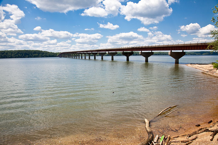
Colbert Ferry, milepost 327.3 – Visit the site where George Colbert once operate a ferry across the Tennessee River. Today the river crossing features a modern bridge, but it is still a great spot to enjoy a picnic or a few hours of fishing. There’s even a boat launch if you want to get out on the river.
Freedom Hills Overlook, milepost 317 – A short, steep trail to the Alabama’s highest point on the parkway.
Mississippi:
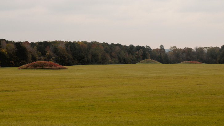
Pharr Mounds, milepost 286.7 – Once the site of a bustling village, this sacred site is now home to eight burial mounds built 1,800 to 2,000 years ago.
Headquarters & Visitor Center, milepost 266 – Watch a film, take in the exhibits, or chat with a ranger at this official visitor center.
Chickasaw Village, milepost 261.8 – Enjoy exhibits about a Chickasaw Indian village that once stood here. Walk the short nature path to learn about native plants, or hop on the Natchez Trace National Scenic Trail for a longer hike.
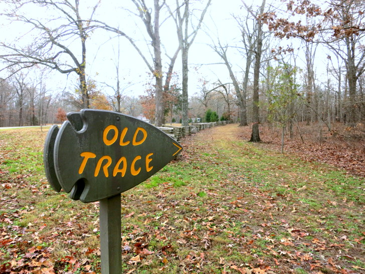
Old Trace, milepost 224.1 and 198.6 – Access a section of the old trace now only suitable for foot traffic.
French Camp, milepost 180.7 – The site of Louis LeFleur’s Stand, or Inn, that first opened in 1812. Today you can visit the museum and gift shop, tour the historic buildings including a blacksmith and post office, or have a bite to eat at the Council House Cafe.
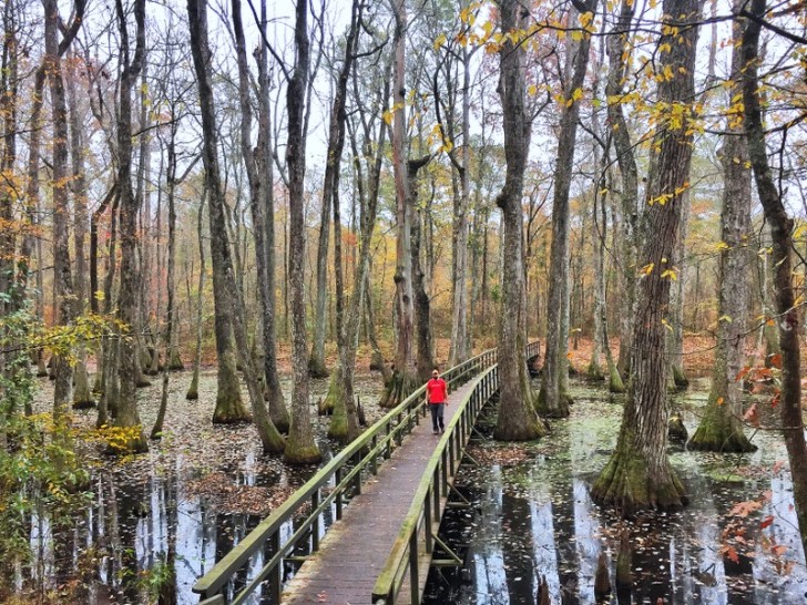
Cypress Swamp, milepost 122 – Stroll the half mile trail through a bald cypress swamp. Observe the peaceful beauty of this swamp and be on the look out for wildlife — including alligators.
Rocky Springs Ghost Town, milepost 54.8 – Hike the 1/2 mile trail to an abandoned ghost town that was once home to a thriving community of over 2,500 residents. Today, all that is left is an old cemetery.
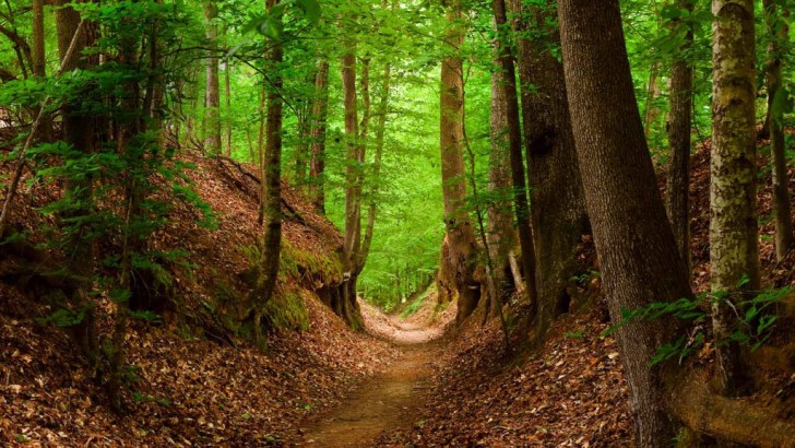
Sunken Trace, milepost 41.5 – Take a short walk through a deeply eroded sunken section of the old trace. This highly photographed area was worn down by heavy traffic during the late 1700s and early 1800s.
Mount Locust, milepost 15.5 – Visit this resorted plantation and learn about the family who once called Mount Locust home. As the sole remaining Inn along the Trace this was once a busting stopping point for the “Kaintucks”, or boatmen, on their way home from floating crops and livestock down the Mississippi River.
Emerald Mound, milepost 10.3 – This massive eight-acre, 35 foot tall ceremonial mound was built by the Mississippian American Indians between 1200 and 1730. Follow the trail to the top and enjoy the view that has remained relatively unchanged for centuries.
Stop and Stay Awhile on the Natchez Trace
The National Park Service operates three free RV and tent campgrounds on the Natchez Trace. All three offer bathrooms with flush toilets and running water, trash cans, and picnic tables. There are no hook-ups or dump stations. They operate on a first come, first served basis and often fill up by mid-afternoon during the busy spring, summer and fall seasons.
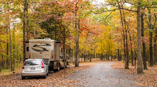
Meriwether Lewis Campground: Located at milepost 385.9, this campground has 32 pull-through and back-in sites suitable for RVs of all sizes.
Jeff Busby Campground: Located at mile marker 193.1, Jeff Busby offers 18 pull-though and back-in sites. About half the sites will accommodate RVs of all sizes, while the rest are only suitable for smaller RVs
Rocky Springs Campground: Located at mile marker 54.8 near the southern end of the Trace, this campground has 22 sites. All the sites are large and can accommodate RVs of any size.
More Campgrounds: There are a number of public and private campgrounds located near the Parkway. You can find a full list by visiting the official Natchez Trace website.
Stuff to Know Before You Go on Your Natchez Trace Trip
- Be sure to stop at the information stations posted at the north and south terminus of the Parkway to obtain a map that includes descriptions of all the historic pull-offs.
- The posted speed limit of 50 mph is strictly enforced.
- Overnight parking is only allowed in designated campgrounds.
- Be alert and watch for wildlife on or near the road.
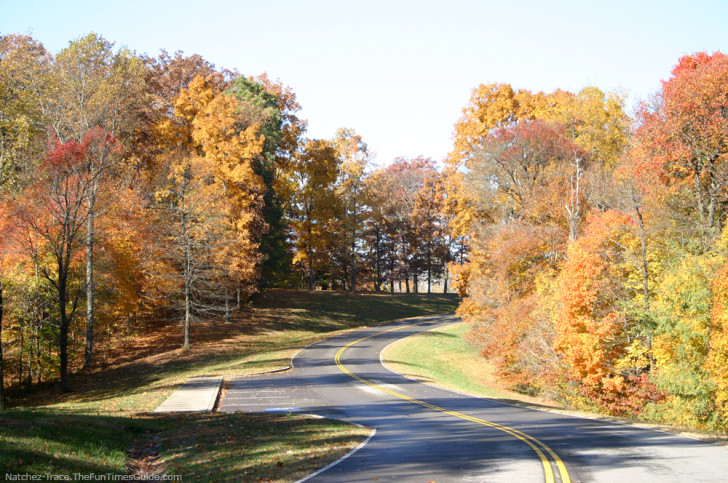
- One of the most popular times to drive the Natchez Trace is September through November when the autumn colors are at their finest.
- The Natchez Trace is a popular bike route with no separate bike lane. Be on alert and always yield to bicycles.
Finally, slow down, make lots of stops, and enjoy your drive through thousands of years of history.